SLOPEz for MapInfo

SLOPEz for MapInfo
SLOPEz is an application for MapInfo Pro that performs various operations involving layers with terrain elevation information. SLOPEz is designed to get the most out of the basic version of MapInfo Professional without raster modules. This application is based on vector and grid tables with Z levels of terrain elevations. It calculates slopes for paths and regions, finds elevations by interpolation, visual line between two locations, direct sun exposure and shadow casts by ridges.
SLOPEz provides a set of buttons to execute the tools, both for MapInfo 32 bits and 64 bits. Results are presented graphically, also as text in the Message window, and through tables:
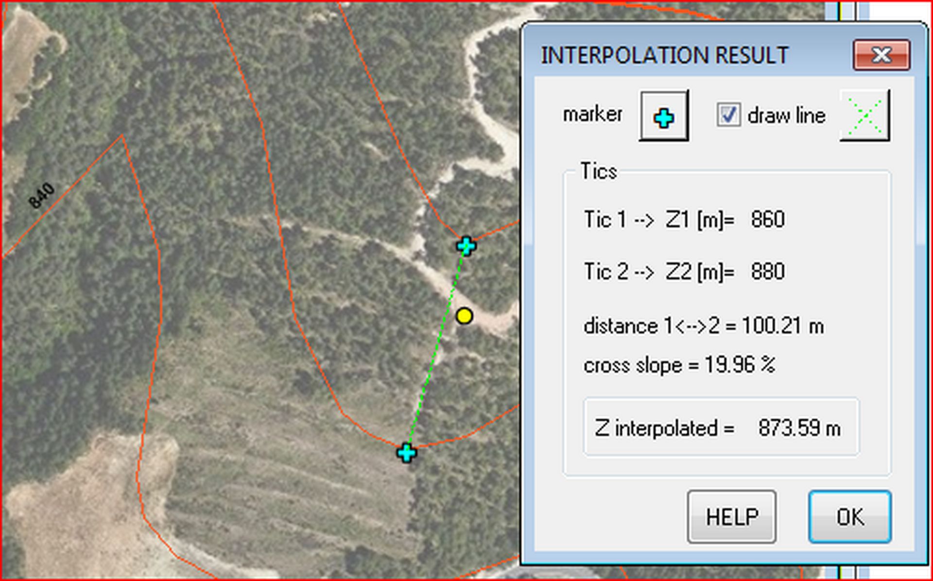
Interpolation:
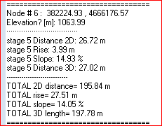
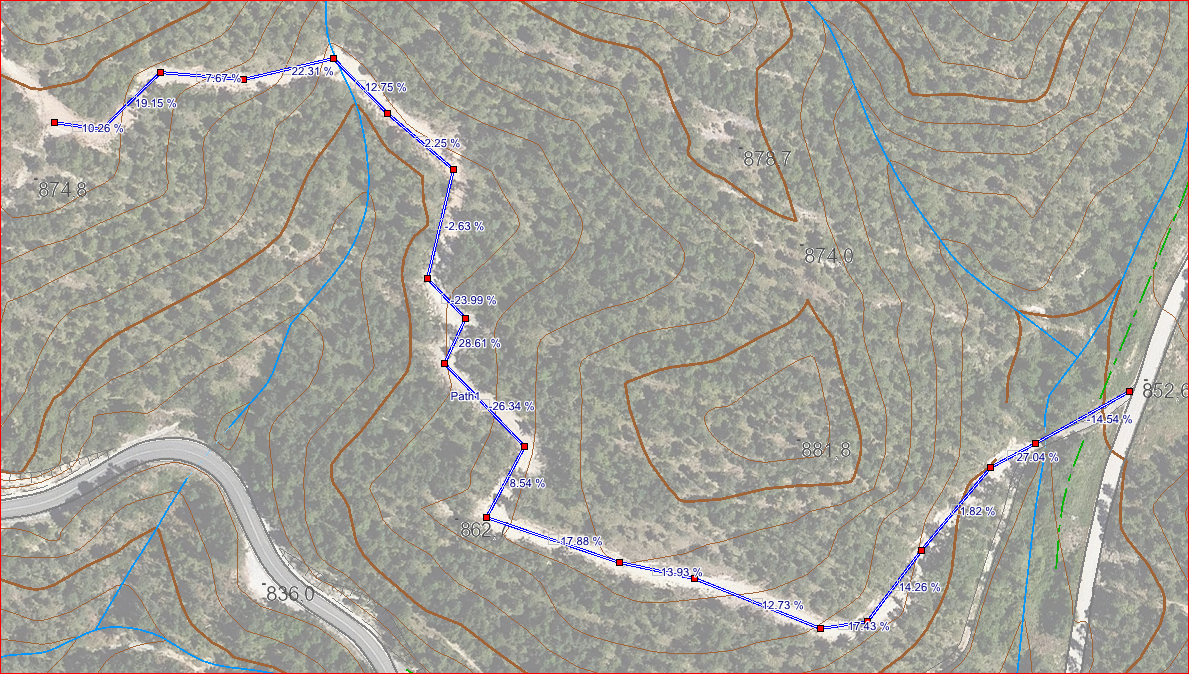
Slopes along a path:
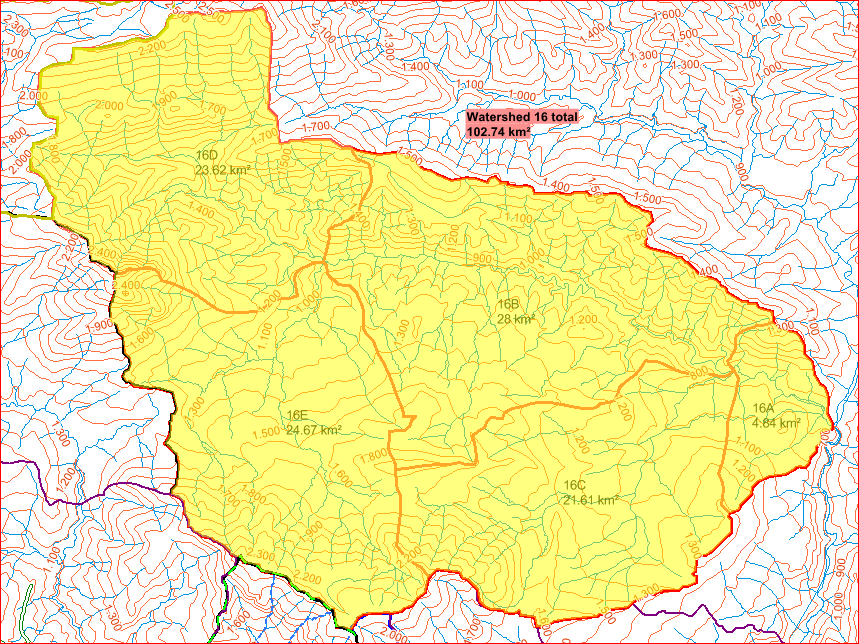
Average Area slope:
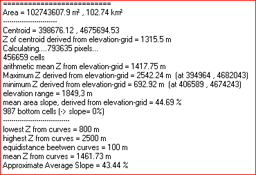
Visibility between two points:
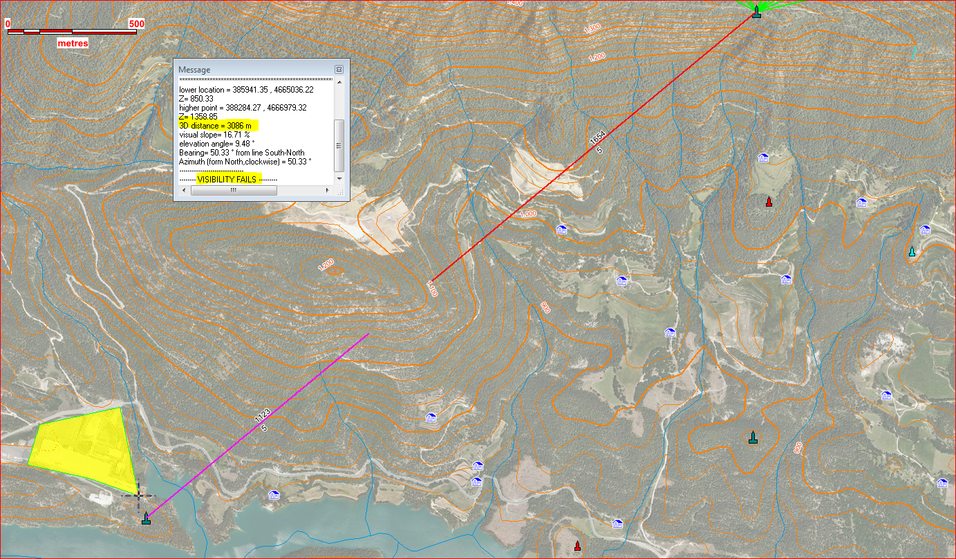
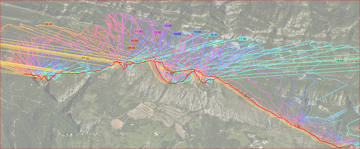
Direct sunlight/shadow:
Shadow projected by ridge:
... and more.
SLOPEz makes complex calculations with just one or few button clicks, while otherwise you would need a lot of operations and mapbasic commands.
This application doesn't substitute old Vertical Mapper or new Pro Raster module, but it provides some functionality not included in them.
SLOPEz neither is aimed to substitute specific detail-design software for paths of routes, pipelines, electric lines, nor surveying software.
It is intended for planning works, where a lot of alternatives are tested. Its scope is to work during study and blueprint fases of a project. Depending on the precision of elevation data and detailed use of the application, it could be able to work at basic-project level.
SLOPEz has been developed for work on a local scale, where cartesian calculations are acceptable.
created with
Website Builder Software .